Foster City feels different from the older Peninsula towns the moment you enter. Instead of a railroad village expanded over time, it was deliberately planned on the former Brewer's Island marshland. Lagoons thread through neighborhoods, bridges cross waterways, and many parks and walking routes were designed as integral parts of the community.
The blue water is not merely decorative. The lagoon functions as part of the storm-drainage system, and the outer levee provides flood protection while also supporting shoreline recreation. That combination of engineering and landscape gives Foster City a distinctive relationship between homes and public infrastructure.
In the late 1950s, developer T. Jack Foster pursued the idea of a new community on a low-lying site east of San Mateo. Land was raised and shaped, drainage basins were created, and a system of residential neighborhoods and civic destinations followed. Foster City later incorporated in 1971.
Because the city was planned rather than simply subdivided in an older street grid, many residential areas have recognizable internal circulation, parks, water features and community associations. The architecture expresses different construction periods, but the organized relationship of homes to common space remains a major theme.
The city uses numbered neighborhoods as part of its planning history, but the lived experience is often better understood by housing type, lagoon access, community facilities, and proximity to major roads. Association boundaries and private access rules matter.
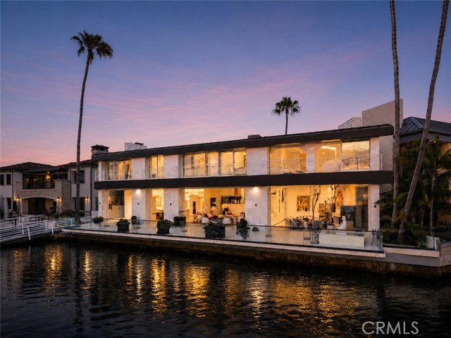
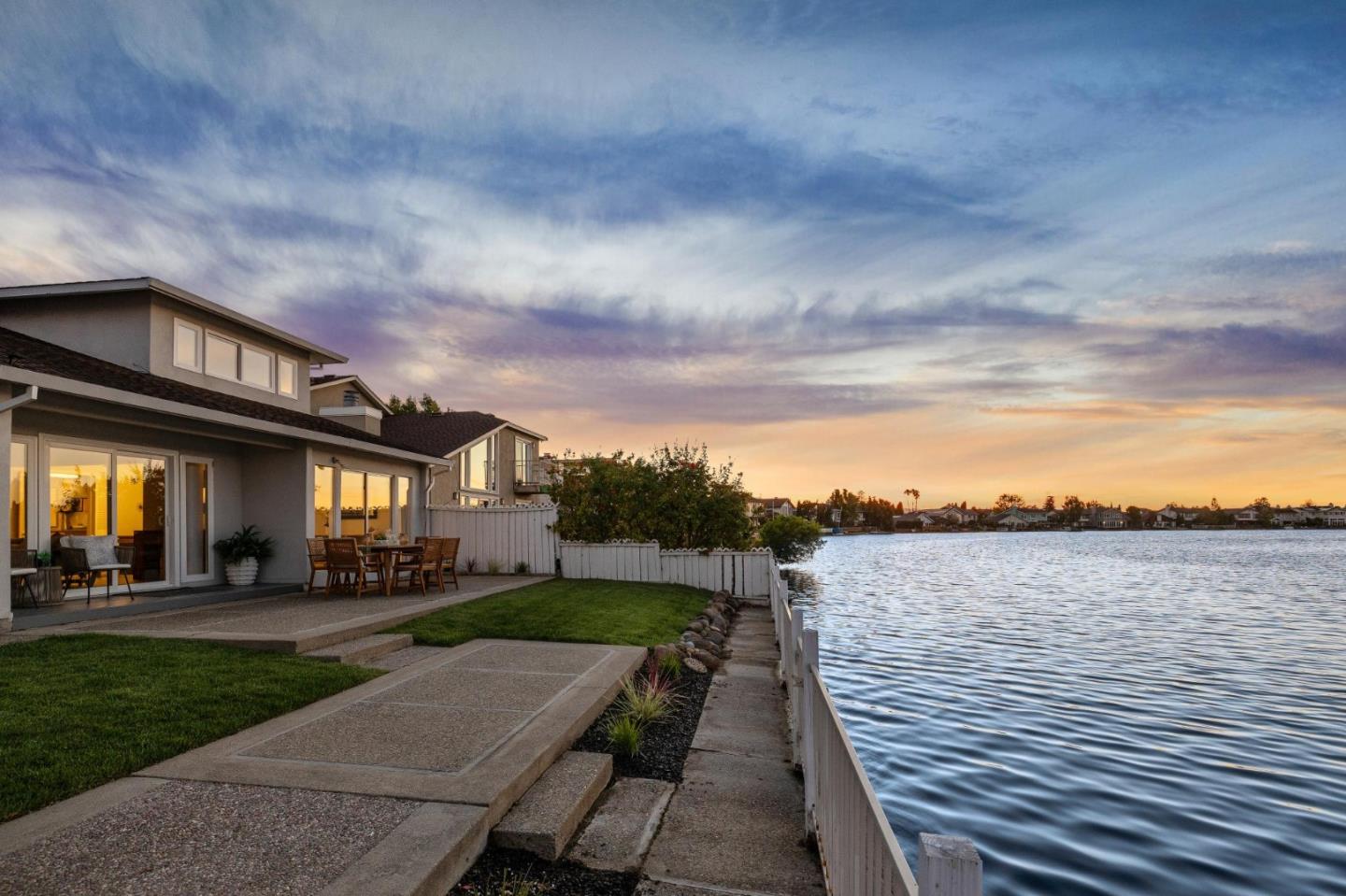
Homes oriented toward the lagoon may have patios, decks and windows framing water rather than a conventional rear yard. Waterfront orientation can create unusual light, reflections and outdoor activity.
Water proximity carries particular obligations. Shoreline edges, docks, association rules, private versus public access, water management and maintenance must be checked rather than inferred from a listing photograph. Two waterfront houses can offer different ownership rights.
Leo J. Ryan Park is one of Foster City's defining places, where the lagoon meets a public landscape and recreation center. Nearby streets benefit from the ability to use parks, community programs, public facilities and local shopping in the same part of town.
Attached housing and single-family homes can have very different operating costs here. HOA responsibilities and the condition of common facilities are as important as the interior finish of a particular residence.
Some homes sit on quieter streets away from the waterfront, with traditional private gardens, playgrounds and neighborhood parks nearby. These are often the places where residents appreciate the relative orderliness of a planned street pattern.
Mid-century and later house designs, remodels and additions create variety within the original plan. Landscaping, street parking, family routines and nearby intersections affect how each block feels.
Foster City has substantial attached housing as well as detached homes. Townhouse and condominium developments can offer shared landscaping, recreation facilities and different levels of exterior maintenance responsibility.
An attractive common waterfront setting does not mean every unit has the same exposure, view, rights, insurance requirements or monthly assessments. Reading governing documents is part of understanding the property and its future obligations.
Along the outer edge, Foster City meets the wider Bay through levees, trails, and employment districts. The sense of open sky and wind differs from the sheltered inner lagoons.
Access to a shoreline route can be a daily pleasure, while exposure to breezes, major roads and other infrastructure may affect specific addresses. The boundary between private community facilities and public paths should be clear.
The city's system of parks, lagoon recreation and trails creates a culture of walking, running, cycling and water-based activity. Leo J. Ryan Park is a visible gathering place, while the Bay Trail gives residents a route around portions of the shoreline.
The lagoon collects stormwater, which is pumped out to the Bay; the levee is a separate flood-protection system. FEMA flood-map status and mandatory insurance requirements can change with engineering and mapping decisions. A designation of lower mapped risk does not mean flood risk is zero, and insurance decisions are individual.
Foster City has neighborhood schools, library and recreation programs embedded in its residential geography. Local school districts are separate agencies, and specific assignments should be confirmed for each address. The city is close to major employers, San Mateo, Redwood Shores, and the San Mateo–Hayward Bridge corridor.
There is no Caltrain station within Foster City. San Mateo and Hillsdale stations and regional bus connections serve different travel patterns, while Highway 92 and Highway 101 shape driving access. It is important to evaluate the actual start and end of a commute rather than only the city name.
Foster City offers a distinct housing proposition: waterfront access and planned amenities can be part of everyday living rather than features reserved for an occasional vacation. At the same time, attached housing, private associations, and lagoon-facing properties require a different valuation approach from detached inland homes.
The most meaningful comparisons separate housing type, HOA cost, lagoon orientation, private improvements, water-related maintenance and infrastructure exposure. Sellers should make those distinctions explicit rather than relying on a generic claim that 'waterfront is always worth more.'
Engineering, insurance, rising maintenance costs and changing flood studies are part of an informed ownership picture. The city's amenity-rich setting is real, but no waterfront address is guaranteed to appreciate.
The lagoon system is engineered as part of the city's original planned development and functions as a stormwater detention and drainage feature. It is also central to the area's recreation and visual character. That dual purpose explains why lagoon management and water-control infrastructure deserve attention when describing nearby homes.
No. The levee is designed for flood protection, and official maps describe particular flood categories, but an engineered system never means risk is zero. Mapping, accreditation, insurance availability and local conditions can change. A buyer or owner should consult current FEMA, city and insurer information for the specific property rather than relying on a general claim about Foster City's safety.
A home may face water without holding private rights to a dock or shoreline improvements. Access, maintenance, association rules, water use and exterior work can differ between developments. Waterfront location is appealing, but ownership rights must be read from relevant legal and HOA documents, not inferred from photographs.
Compare like with like: direct water orientation, detached versus attached housing, improvements, monthly assessments, reserves and neighborhood access. Wen Group's local real-estate approach should explain both lifestyle and ownership responsibilities. A beautiful lagoon setting is most persuasive when the description of the property is complete and precise.
Foster City is a place where landscape planning and ordinary family routines overlap. The same lagoon that stores rainwater also frames a sunset walk; a levee designed for protection becomes a bike route. That combination of infrastructure and leisure is its most distinctive local story.
Browse the available properties in the area below.
Browse the available properties in the area below.