Los Altos has a quieter rhythm than many of its Silicon Valley neighbors, but it is not a place without activity. A walk through Downtown brings independent shops, sidewalk tables, restaurants, and small civic spaces into view. Just beyond the commercial streets are established neighborhoods where houses sit behind gardens and mature trees. Farther south, residential blocks connect to parks and smaller shopping districts; toward the western edge, the land begins to rise in the direction of Los Altos Hills. Those changes happen within a relatively compact city, and they are the reason Los Altos cannot be described through one image of a tree-lined street or one style of home.
For residents, the city's identity is made up of repeated local routines. Someone might begin the morning at a café on Main Street, take a child to a neighborhood park, stop by the library, and return home through streets where every garden is a little different. Someone else may spend a quiet afternoon among the redwoods along Adobe Creek or meet neighbors at the Los Altos Community Center. The city's commercial areas are comparatively small and distributed, so a home near Downtown feels different from one oriented toward Rancho Shopping Center, Loyola Corners, or Woodland Plaza.
Los Altos is also closely linked to neighboring Mountain View, Palo Alto, Cupertino, and Los Altos Hills. Jobs, schools, transit, and recreation often cross city boundaries, yet the city retains its own civic identity and residential design traditions. What makes a particular neighborhood memorable is not simply where it sits on a map; it is the interplay of street layout, architecture, lot configuration, vegetation, natural light, and the places people use every week.
The story of modern Los Altos begins with a railroad. In 1906, Southern Pacific executive Paul Shoup and his associates formed the Altos Land Company and acquired about 140 acres from Sarah Winchester. They envisioned a town along the railway cutoff linking Mayfield and Los Gatos. The name Los Altos, meaning “the heights,” referred to the land's position along that route. In March 1907, the land company held an outdoor gathering and lot sale near today's Main Street and Foothill Expressway, creating an early center for the growing settlement.
The railroad helped shape the town's first commercial streets and residential parcels. The historic depot on First Street, built in 1913, remains a reminder of that era. Around it, a collection of early businesses and homes appeared, followed by a larger farming community that supplied fruit to the region. Los Altos and the surrounding valley had orchards and agricultural land long before contemporary technology offices and modern residential streets became familiar landmarks.
After World War II, demand for housing reshaped the landscape. Orchard parcels were subdivided, single-story ranch homes spread across new streets, and schools and parks became the centers of a growing residential community. Los Altos incorporated on December 1, 1952. Passenger and railroad activity eventually declined, and when Southern Pacific service ended in 1964, the former rail right-of-way was converted into Foothill Expressway. That transformation explains an unusual piece of local geography: one of today's important roads follows the path of the railway that helped establish the town.
Los Altos also belongs to the early history of personal computing. Steve Jobs and Steve Wozniak's work on the first Apple computers in Los Altos is part of the wider Silicon Valley story. The house associated with that history is a private home, not a public attraction. For daily life, the more visible connection to the past lies in the preserved railroad building, historic commercial architecture, neighborhood street patterns, and the surviving orchard near the civic center.
That layered history is why Los Altos contains both early twentieth-century houses near the original Village and large stretches of mid-century residential development. Its architecture should be read as a sequence of periods and individual decisions rather than one consistent suburban style.
Neighborhood names in Los Altos are commonly used by residents and real estate professionals, but their edges are not always official city boundaries. The descriptions below follow recognizable local areas and built environments rather than treating every label as a uniform subdivision. Also important: Los Altos and the Town of Los Altos Hills are separate municipalities, while some properties with Los Altos mailing addresses may lie in unincorporated Santa Clara County. Municipal services, building rules, and school assignments should be confirmed for each address.
Downtown Los Altos grew around the early railroad settlement and still feels like a village rather than a large commercial center. Main Street and State Street offer the everyday pleasures of browsing bookstores and boutiques, meeting over coffee, trying a new restaurant, or lingering outside on a mild evening. Smaller plazas and outdoor dining spaces make the public realm feel close to the buildings instead of separated from them by vast parking areas.
The historic Southern Pacific depot, the Shoup Building, and other early storefronts reveal how the town's commercial architecture developed. The neighboring civic area brings the library, Los Altos History Museum, Hillview Park, and Community Center into the wider Downtown experience. At the Los Altos History Museum, the J. Gilbert Smith House and agricultural exhibits provide an accessible connection to the town's orchard-era life.
Housing near the Village is more varied in age, scale, and form than the planned ranch neighborhoods farther south. Older houses, renovated properties, new residences on established lots, and some attached housing all contribute to the mix. The ability to walk to local shops or public events is meaningful for people who enjoy a more connected daily routine; street parking, busy corners, and proximity to major roads can be just as important to the character of a particular block.
Old Los Altos, generally associated with residential streets near University Avenue and the historic core, has some of the city's strongest visible connections to its early development. Traditional rooflines, porches, mature trees, and older homes appear alongside renovations and new architecture. Rather than one uniform house style, the neighborhood feels like a series of individual properties that have evolved over a century of changing needs.
The landscape is especially memorable around Shoup Park and Redwood Grove Nature Preserve. Adobe Creek, shaded paths, and outdoor gathering spaces give this side of the city an intimate relationship with nature. A house within walking distance of a creekside trail offers a different everyday experience from a larger residence farther from the Village, even when both share the same city identity.
For homeowners, caring for older architecture often raises questions of preservation, foundations, additions, trees, and how new work fits among established structures. Historic status cannot be presumed merely because a house looks old; the city has specific rules for designated historic resources. The pleasure of the area lies partly in how gardens, buildings, and the public streetscape continue to coexist.
North Los Altos includes many of the mid-century residential blocks between the original town center and the neighboring Palo Alto and Mountain View edges. A mixture of low-profile ranch homes, renovated houses, and substantial contemporary replacements now sits beneath an established tree canopy. In many places, relatively simple house forms let the landscaping and outdoor space carry much of the street's character.
The area has a practical relationship to the library, Los Altos High School, Hillview Park, the Community Center, and the shops and restaurants of Downtown. Those institutions make its residential setting feel connected without making it a dense urban neighborhood. Sidewalks, street widths, school routes, and proximity to Foothill Expressway differ by block, so the everyday experience is not captured by the broad North Los Altos label.
As older single-story houses are remodeled or replaced, architectural scale becomes especially noticeable. A new home's roof massing, daylight, windows, front garden, and the spaces left between buildings influence both private enjoyment and the public feel of the street. Some of the most successful updates preserve that sense of openness even while changing the floor plan substantially.
Central Los Altos is a broad residential area whose streets reflect the city's postwar growth. Ranch houses, updated mid-century properties, and newer custom construction create a layered but familiar environment of front lawns, gardens, and private outdoor spaces. Not every part has the same lot size, street width, or walking access, so the sense of neighborhood emerges from specific routes and nearby destinations.
Rosita Park and connections toward Rancho Shopping Center are useful points of reference for many central blocks. A resident's day may revolve around a local school, a sports field, or a neighborhood shopping stop rather than the Village. For that reason, Central Los Altos deserves to be understood on its own terms: a lived-in residential network with its own everyday amenities, not merely an area between Downtown and South Los Altos.
Rancho is closely associated with the shopping district around Foothill Expressway and Springer Road. The surrounding blocks express a clear part of Los Altos's mid-century identity, with single-story homes, established gardens, and floor plans that often turn toward a private backyard. Contemporary remodels may open interior rooms to one another or bring in more light, while larger new homes have changed the proportions of certain streets.
Rancho Shopping Center provides a convenient local destination for groceries, meals, and other errands. Rosita Park and Grant Park are also part of the broader daily geography. This is one of the areas where a resident can appreciate the contrast between a relatively quiet residential street and the small commercial centers that make an otherwise low-density city practical to live in.
The architecture rewards attention to how a house sits on its parcel. A broad one-story footprint may preserve privacy and a generous garden, while a new two-story design changes sunlight and sightlines. Neither approach should be judged only by finished square footage; layout, setbacks, planting, and outdoor circulation all shape the experience.
Loyola Corners is centered near the intersection of Foothill Expressway, Fremont Avenue, and Miramonte Avenue. The district's name reaches back to the area's railroad and planned-institution history. Today it is a modest commercial node serving surrounding homes rather than a full downtown, with shops and services that many residents use as part of a short local routine.
Homes around Loyola Corners include a wide range of mid-century and remodeled properties. The broader neighborhood offers familiar garden streets, but major-road crossings and proximity to the intersection create different conditions from one address to another. Nearby McKenzie Park and Marymeade Park are additional destinations for recreation and casual gatherings.
The name Loyola also appears in connection with neighboring unincorporated county land and the Country Club area. It should not be treated as a guarantee of municipal jurisdiction or a particular school placement. The area is a good example of why local history and actual address boundaries both matter in understanding Los Altos.
The Country Club area, near the Los Altos Golf & Country Club and the western edge of the city, has a different scale from many of the flatter ranch-house neighborhoods. Residential parcels and landscaping vary, and some properties sit on gently changing land with mature trees and more individualized house designs. A larger parcel may allow a residence to sit more quietly within its garden, but useful outdoor space and views still depend on the site's actual shape and orientation.
The Los Altos Golf & Country Club is a private institution, not a public park, and its presence is not the same as general public access to its grounds. The area's larger landscape context brings the foothills close, even as residents continue to use the city's commercial centers, parks, and regional roads.
One crucial distinction is that parts of the broader Country Club and Loyola vicinity are unincorporated Santa Clara County despite using Los Altos addresses. Building jurisdiction, land-use rules, road services, and other matters need property-specific confirmation. A Los Altos mailing address alone does not make a property part of the incorporated City of Los Altos, and it does not make it part of the separate Town of Los Altos Hills.
South Los Altos reaches toward the boundaries with Cupertino, Sunnyvale, and Mountain View and has its own extensive pattern of residential streets. Mid-century ranch houses remain an important part of its architectural character, alongside substantial remodels, two-story traditional houses, and contemporary replacements. Some pockets also include original California modernist homes associated with Eichler development.
Grant Park provides play areas, sports facilities, picnic spaces, and opportunities for neighborhood gatherings. Smaller retail destinations and other parks spread across the southern side of town support daily errands and activities without requiring every trip to pass through Downtown. The area is best understood through its individual schools, parks, and street connections rather than a general north-versus-south reputation.
School-district boundaries become particularly important in this part of Los Altos. Some properties are in the Los Altos School District, while others are in the Cupertino Union School District, and high-school service may differ as well. Those boundaries do not follow a simple neighborhood nickname or postal code; even nearby homes can require separate checks.
Woodland Acres and the Highlands are often grouped together in local neighborhood descriptions, but their residential environments have recognizable differences. Compared with many of the city's older grids, parts of these areas feature curving streets, cul-de-sacs, and established trees that create a sheltered atmosphere. Ranch-era houses, additions, and larger replacement homes reveal how residents have adapted these neighborhoods over time.
Woodland Acres often retains the strong horizontal vocabulary of mid-century residential design—low roofs, a close relationship to the yard, and homes set among gardens. The Highlands includes more varied massing and some two-story construction, reflecting different building periods and individual choices. Woodland Plaza, Montclaire Park, and the Woodland Branch Library are useful neighborhood landmarks, each adding to the area's everyday connections.
Southwestern Los Altos can be close to regional parks and foothill access, but the city, county, and school boundaries are not interchangeable. For any particular home, the accurate questions concern its real jurisdiction, street access, tree canopy, school district, and the way natural light and private gardens work throughout the year.
The Fallen Leaf Park area offers another facet of Los Altos residential design through a small concentration of Eichler-era modern homes. Across Southern Los Altos, these low-profile designs stand out for broad glazing, exposed beams, atrium or courtyard relationships, and a deliberate continuity between interior rooms and gardens. Individual houses vary in originality and condition; not every mid-century property is an Eichler, and alterations can change a design substantially.
This modernist tradition is important because it reveals a different idea of residential luxury. Light, privacy, circulation, and outdoor space can create a strong architectural experience without relying on ornament or the tallest possible house. Preserving the relationship between roof, glazing, garden, and neighboring homes is often central to a thoughtful renovation.
Los Altos has more neighborhood commercial life than its small Village suggests. The city identifies seven retail districts: Downtown, Loyola Corners, Rancho Shopping Center, Village Court, Woodland Plaza, Foothill Crossing, and El Camino Real. They serve different needs and feel different from one another. Downtown invites walking, dining, and browsing; the smaller centers make grocery runs, takeout, and practical errands more convenient for people living away from Main and State streets.
Downtown itself is known for local restaurants, cafés, specialty shops, bakeries, and a streetscape that makes it pleasant to meet friends without turning the outing into a large shopping excursion. State Street and Main Street are places where public events and storefront changes become part of the city's shared conversation. Food choices span casual lunches, coffee and pastries, markets, and more occasion-oriented dining. Individual tenants can change, so the enduring feature is the scale and mix of the district rather than a fixed list of restaurant names.
The Downtown Los Altos Farmers' Market takes place seasonally on State Street, bringing produce, flowers, and other goods into an already walkable setting. Events organized by the Village Association and city create additional reasons to visit. Downtown works in tandem with the neighborhood centers rather than replacing them: some residents come to the Village for a leisurely evening and use Rancho or Woodland Plaza for a quick weekday errand.
Shoup Park is one of Los Altos's signature public spaces. It lies near University Avenue and Adobe Creek and includes lawns, playgrounds, picnic areas, and gathering facilities. From Shoup Park, a path leads into Redwood Grove Nature Preserve, where a boardwalk and creekside trails give an unusually wooded experience so close to the Village. The shift from a busy restaurant street to the shade of tall trees is one of the city's most memorable transitions.
Hillview Park connects with the Community Center and civic campus, bringing playing fields, a playground, and recreation into a setting close to the library and museum. Grant Park and Rosita Park support sports, picnics, and neighborhood outings farther south. McKenzie Park, Marymeade Park, Heritage Oaks Park, Montclaire Park, and other smaller parks help distribute outdoor life throughout the city. The details differ: some are valued for active fields and courts, others for a playground, picnic table, or familiar walking route.
Beyond the city limits, the Rancho San Antonio open-space area is a regional hiking destination, but it is not a City of Los Altos neighborhood park. The proximity of this larger landscape, together with the city's own creek corridors and gardens, helps explain why outdoor living is important locally. Park entrances, trail conditions, and the practical route from a given house matter more than straight-line distances on a map.
Schools shape many families' routines and are important civic institutions in Los Altos. The Los Altos School District serves much of the city at elementary and middle-school levels, while portions are served by Cupertino Union School District. At the high-school level, families may fall within Mountain View–Los Altos Union High School District or Fremont Union High School District depending on address. The city identifies these separate districts in its public resources.
Los Altos High School is located near the civic center, and the Mountain View–Los Altos district also operates Mountain View High School. The correct district and school should always be confirmed with official address tools and current enrollment policies. A postal address, nearby elementary campus, or neighborhood name alone cannot establish eligibility, school placement, or the availability of particular programs.
Two Santa Clara County Library District branches serve Los Altos: the main Los Altos Library and the Woodland Branch Library. The Los Altos Community Center, opened in 2021, adds spaces for classes, youth and senior programs, meetings, and public gatherings. Across generations, these are the places where residents build a shared sense of community beyond the boundaries of their own street.
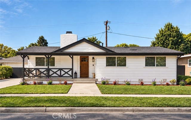
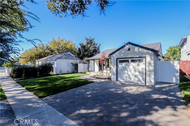
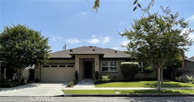
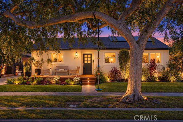
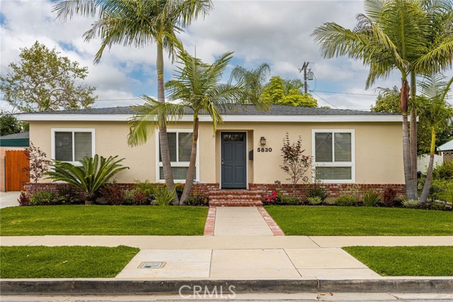
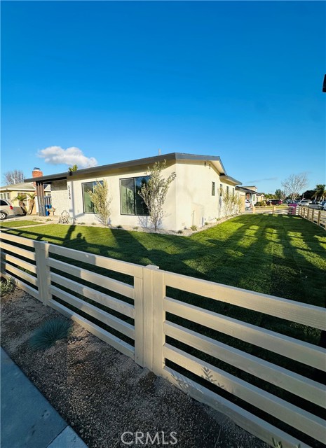
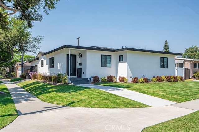
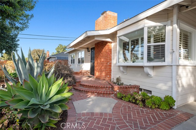
The residential landscape of Los Altos is especially interesting from an architectural point of view because it contains both generous land and a tradition of relatively modest building forms. Many established streets were shaped by single-story houses, broad garden setbacks, and mature landscaping. Over time, some properties have retained these original forms; others have been transformed into larger contemporary, Craftsman-inspired, Mediterranean, or transitional homes.
A well-composed residence makes use of its site, not simply its maximum permitted floor area. On a relatively level parcel, the position of windows, privacy from neighboring rooms, usable garden space, and the sequence from the front entrance to outdoor living areas can change how spacious a home feels. A lower roofline may preserve a view of the trees from the street; carefully placed skylights or a courtyard may bring light into a deeper plan. These are design choices rather than guarantees associated with a particular neighborhood.
Los Altos has a residential design-review framework that addresses new construction and major additions, including neighborhood compatibility, massing, landscaping, and the character of surrounding properties. The city also has rules protecting certain trees and separate procedures for designated historic resources. That means renovations are not merely a matter of selecting finishes: owners need to understand current zoning, approvals, tree protections, construction records, and the actual scope of a proposed improvement.
In a market where land and architecture both matter, two houses of similar interior size may create very different experiences. One may benefit from a thoughtful floor plan, daylight, quiet outdoor rooms, and a coherent relationship to its landscape; another may provide more built area but less usable private space. For long-time homeowners, sellers, and future residents alike, understanding these distinctions helps reveal what is enduring about an individual property without reducing its character to a number.
People comparing homes in Palo Alto and Los Altos often notice a difference before looking at any market statistics: in many Los Altos neighborhoods, the residential lot feels more generous and the house sits lower in the landscape. Broad, relatively level parcels, single-story ranch homes, established gardens, and a strong indoor-outdoor relationship are part of the city's built identity. Much of its traditional single-family zoning has been organized around comparatively large lots, though actual parcel sizes and conditions vary. This helps explain why Los Altos can appeal to households seeking room to garden, entertain, or enjoy daily life across one floor without leaving the center of Silicon Valley.
That physical character creates an important distinction between land value and building value. A well-positioned lot is a finite site in an established community; the house on it may be preserved, extensively remodeled, or replaced over time, subject to current city standards. A dated ranch house is not necessarily lacking in value simply because its finishes are older. Its setting, orientation, usable yard, privacy, and potential for an architecturally coherent renovation may be significant parts of the property's appeal. Likewise, a carefully designed one-level home can be luxurious precisely because it does not consume every possible inch of its lot.
Los Altos has also shown meaningful strength in recent Silicon Valley housing studies. In one 2026 repeat-sales analysis, the same-size detached homes sampled in Los Altos had stronger annualized appreciation than those sampled in several nearby cities. That is useful historical context, but it does not establish that Los Altos leads in every period or that land values can only rise. Short-term citywide medians may tell a different story because the homes sold in one month or year are not identical to those sold before. A responsible understanding separates long-term scarcity and desirability from the price of any particular transaction.
Compared with Palo Alto, which is often valued for its internationally recognized Stanford and technology connections, parts of Los Altos offer a more garden-oriented version of Silicon Valley residential life. The comparison is not absolute: Palo Alto has estate-size lots, and Los Altos has compact homes near its Village. For current homeowners and future residents, the important questions are specific: how much of the lot is usable, whether a single-level plan works well, how architecture relates to outdoor space, and how the street connects with schools, shops, and everyday routines. Those are qualities that can remain meaningful long after a particular market cycle has passed.
Los Altos no longer has a passenger train station within city limits. Its railroad history survives in the former depot and Foothill Expressway, while today's Caltrain access is through stations in neighboring cities such as San Antonio and Mountain View. The practical journey varies by starting street, schedule, walking or cycling route, and the first or last connection. VTA bus service and local transportation programs also connect parts of the city with the larger region, but routes and frequency should be checked before relying on them.
Foothill Expressway, El Camino Real, Interstate 280, and State Route 85 serve different directions of travel. The city's lower-density neighborhoods mean daily transportation may include a combination of walking, cycling, driving, and regional rail. A home close to Downtown can support many short errands on foot, while a street on the western or southern edge may be more naturally connected to a park or neighborhood shopping center. Ease of travel depends on crossings, traffic, bicycle routes, and the actual destination—not a single promise of how many minutes it takes to reach work.
Los Altos experiences the generally dry summers and wetter winters characteristic of much of the Santa Clara Valley. Its mild climate supports outdoor meals, gardens, neighborhood walking, and park activities through much of the year. Yet sunlight and temperature can still feel different beneath a mature tree canopy, along a creek corridor, in an open south-facing garden, or near the western foothills.
Trees are part of the city's identity and a practical aspect of homeownership. They shade homes and streets, soften the scale of buildings, and support habitat. They also require attention to roots, pruning, drought conditions, and the location of proposed additions or underground work. Water use, stormwater drainage, and summer heat increasingly shape landscape decisions. The city's climate-adaptation plan addresses heat, drought, major storms, and other regional risks, with the specific effects varying by property.
The result is a city where garden design and building design are closely connected. Window placement, seasonal shade, outdoor seating areas, native planting, and appropriate tree care all affect how a home functions. A landscape that looks beautiful in spring may create a different experience in midsummer or during winter rain; a lasting design takes all of those conditions into account.
The identity of Los Altos is closely tied to its low-rise neighborhoods and village-scale commercial life, but the community continues to change. Existing houses are remodeled and rebuilt, while discussions about housing types, downtown development, and El Camino Real reflect broader regional housing needs. The city's commercial corridors are not interchangeable with its interior residential streets; what changes in one area may have a different effect on the other.
For residents and property owners, the useful distinction is between adopted rules, a proposed plan, an approved project, and something already built. Each can shape expectations differently. Keeping track of city planning, tree protections, neighborhood compatibility standards, school policies, and actual nearby construction provides a more grounded picture than assuming Los Altos will stay exactly as it is or change all at once.
Los Altos brings together a distinctive collection of places: an early railroad village, surviving orchard history, restaurant and shopping streets, shaded creekside redwoods, neighborhood parks, schools, and houses spanning a century of residential architecture. It has the everyday convenience of being part of Silicon Valley, yet many of its most recognizable qualities are small in scale—garden walls, familiar cafés, a park reached on foot, and streets where trees remain as important to the view as buildings.
For some residents, the center of life is Downtown. For others, it is a school or park in South Los Altos, a familiar errand at Rancho, the quiet of Woodland Acres, or the distinctive landscape near the western Country Club area. No one neighborhood represents every version of Los Altos. The city's identity becomes richer when its homes are understood together with their history, surroundings, and the routines of the people who live there.
Browse the available properties in the area below.
Browse the available properties in the area below.